


HARWOOD Voting District, Champaign County, Illinois
About
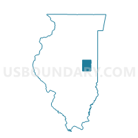
Outline

Summary
| Unique Area Identifier | 564798 |
| Name | HARWOOD Voting District |
| County | Champaign County |
| State | Illinois |
| Area (square miles) | 36.86 |
| Land Area (square miles) | 36.85 |
| Water Area (square miles) | 0.01 |
| % of Land Area | 99.97 |
| % of Water Area | 0.03 |
| Latitude of the Internal Point | 40.36369850 |
| Longtitude of the Internal Point | -88.06937860 |
Maps


Graphs
Select a template below for downloading or customizing gragh for HARWOOD Voting District, Champaign County, Illinois


Neighbors
Neighoring Voting District (by Name) Neighboring Voting District on the Map
- BUTTON Voting District, Ford County, IL
- COMPROMISE-GIFFORD Voting District, Champaign County, IL
- KERR Voting District, Champaign County, IL
- LUDLOW 1 Voting District, Champaign County, IL
- LUDLOW 3 Voting District, Champaign County, IL
- PATTON 7 Voting District, Ford County, IL
- RANTOUL 6 Voting District, Champaign County, IL
Top 10 Neighboring County Subdivision (by Population) Neighboring County Subdivision on the Map
- Rantoul township, Champaign County, IL (11,273)
- Patton township, Ford County, IL (5,358)
- Ludlow township, Champaign County, IL (4,278)
- Compromise township, Champaign County, IL (1,463)
- Harwood township, Champaign County, IL (623)
- Button township, Ford County, IL (281)
- Kerr township, Champaign County, IL (163)
Top 10 Neighboring Place (by Population) Neighboring Place on the Map
Top 10 Neighboring Elementary School District (by Population) Neighboring Elementary School District on the Map
- Rantoul City School District 137, IL (12,520)
- Gifford Community Consolidated School District 188, IL (1,844)
- Ludlow Community Consolidated School District 142, IL (918)
Top 10 Neighboring Secondary School District (by Population) Neighboring Secondary School District on the Map
- Rantoul Township High School District 193, IL (17,512)
- Armstrong Township High School District 225, IL (1,421)
Top 10 Neighboring Unified School District (by Population) Neighboring Unified School District on the Map
Top 10 Neighboring State Legislative District Lower Chamber (by Population) Neighboring State Legislative District Lower Chamber on the Map
Top 10 Neighboring State Legislative District Upper Chamber (by Population) Neighboring State Legislative District Upper Chamber on the Map
Top 10 Neighboring 111th Congressional District (by Population) Neighboring 111th Congressional District on the Map
Top 10 Neighboring Census Tract (by Population) Neighboring Census Tract on the Map
- Census Tract 104, Champaign County, IL (4,809)
- Census Tract 102.04, Champaign County, IL (4,620)
- Census Tract 101, Champaign County, IL (4,582)
- Census Tract 9617, Ford County, IL (2,236)